FONT DE L’ARBRE to AITANA SUMMIT
Think about your car before you drive to the start of this magnificent route! The quick way is rough – going via Confrides is probably the best option – particularly if you have a Hire Car!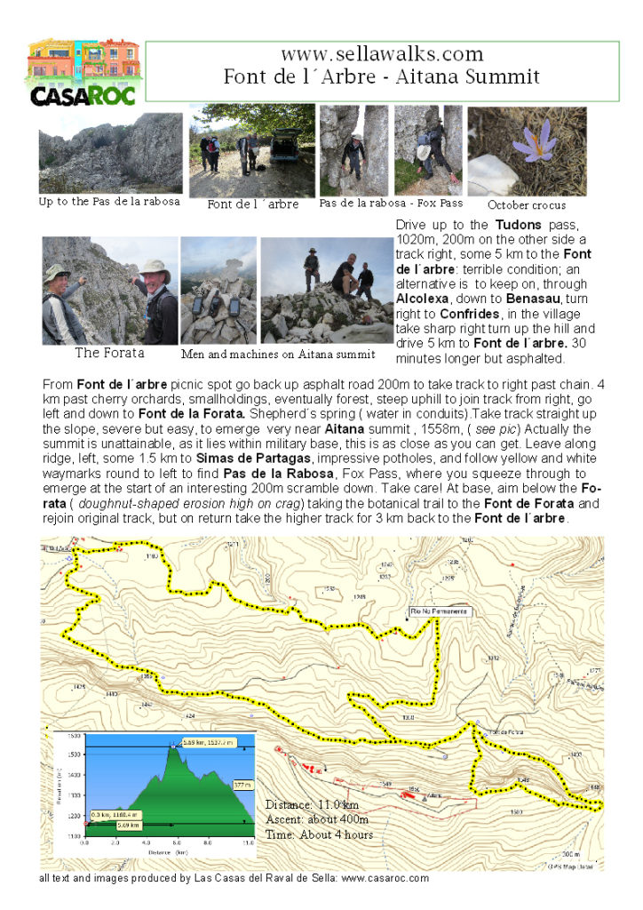
SELLA-RELLEU-SELLA
A simple circular route but with many navigational issues – when I learn how , I’ll put up a GPX track which will make it easier. But where better to be lost than in the Sella Hills!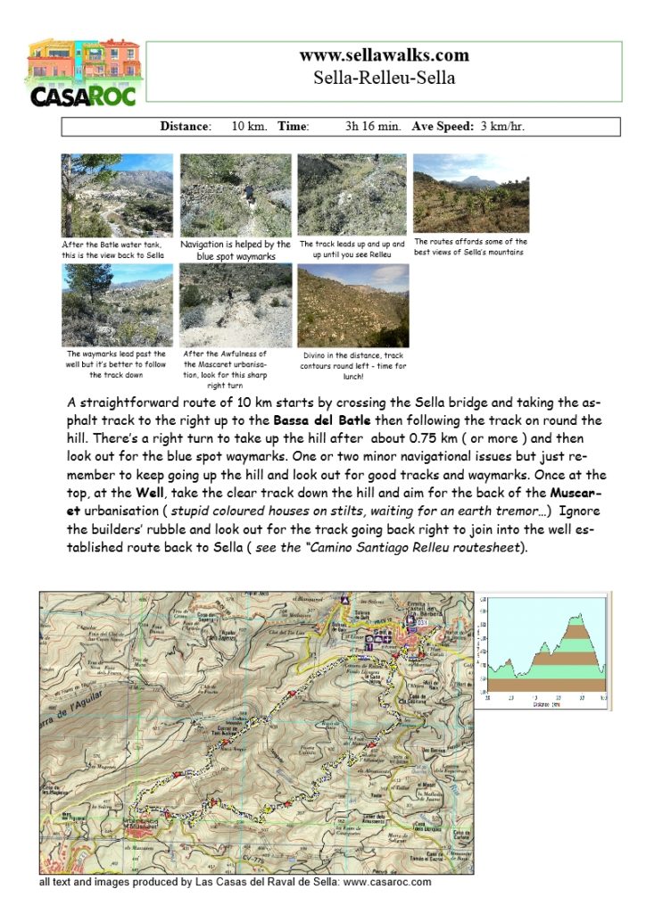
sella-to-relleugdb sella-to-relleugpx
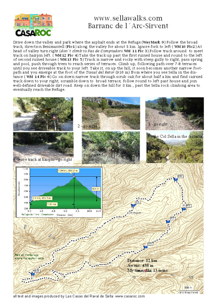
BARRANC de L;ARC – SIRVENT
In Gill’s book it’s ” Below the Paso de Comptadores” or something similar. This is my number one route near Sella! Varied, not too long. great views. You just have to drive out to the Refugio to start with
( or walk there – another 5 km at start and finish)
Barranc-Sirvent gdb Barranc -Sirventgpx
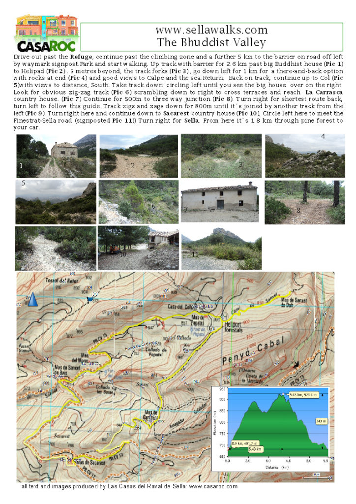
BHUDDIST VALLEY
In Gill’s book it’s Sanchet because she takes you up along the challenging ridge – you don’;t have to go there, unless you fancy a rock scramble…
LA RUTA DEL AGUA
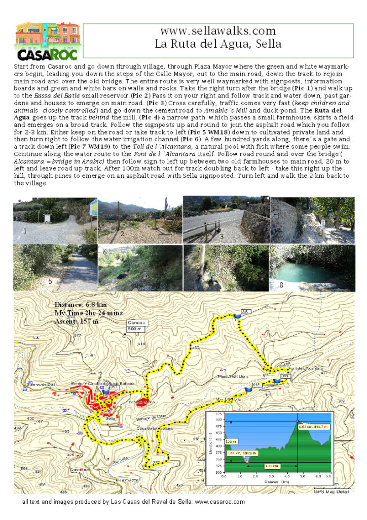
Circular from Sella, well waymarked (green/white) and only 2 or three hours. Great little walk following Sella’s ancient waterways and going past the Mill.
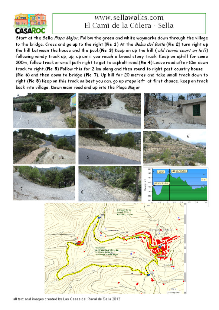
EL CAMÍ DE LA CÓLERA
Ancient path to avoid Sella in times of Cholera epidemics in the 19th century. Now an amiable and easy route for a 1.5 – 2 hour amble.